


Townships and Ranges
How to find your land:
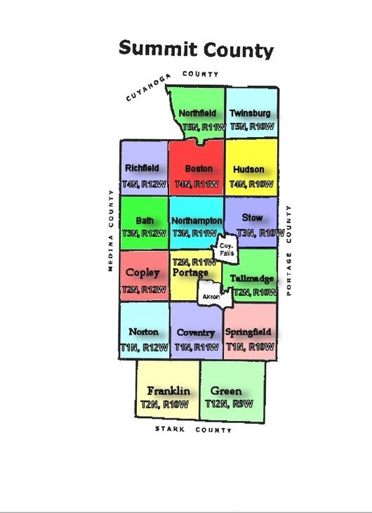
Original land patents and old deeds often describe the location of lands by Range, Township, Section, and Quarter sections mapped under provisions of the Northwest Ordinance enacted on 13 July 1787. To determine where the land mentioned in a deed is located you must know where each Range, Township and Section are located. The Map below shows the Township and Range numbers for each township in Summit County to help you determine where your ancestor's land was located.
All of the townships in Summit County were part of the Connecticut Western Reserve survey, except for the townsips of Green, and Franklin. The townships of Green and Franklin were part of the Congress Lands survey.
Summit County OHGenWeb Page
Established November 20, 1996